Inspection-grade visualization for high-fidelity spatial data.
RadianceView is the lens, not the camera. We unify mobile 3D scans, traditional LiDAR, and Gaussian splats with high-resolution photography into a single, trusted reference — built for teams who decide from what they see.

From raw data to trusted reference.
A single layer between every capture method and every decision. RadianceView reduces ambiguity — it does not add features for their own sake.
Multi-source fusion.
Combine mobile LiDAR, traditional 3D scanners, Gaussian splats, and high-resolution photography. One reference. No format wars.
Inspection-grade clarity.
Identify hairline fractures, corrosion, and wear at the same fidelity as on-site. Spatial content stays the hero — not the UI.
Grounded intelligence.
Detect anomalies, extract serials, query physical assets in plain language — every answer anchored in captured visual evidence.
One layer.
Every format.
Most platforms force a choice. RadianceView treats every spatial primitive as a first-class citizen — Gaussian splats and meshes and point clouds, in the same view, at the same time.

The fidelity of a photograph.
The depth of a scan.
RadianceView is Gaussian-splat native. The console is built around the spatial data, not the other way around.

Where teams already trust it.
Documentation that once took days of manual work now happens in minutes — with far greater accuracy, consistency, and detail.
Aerospace — Parts reuse
Case study · 2026Retired airliners documented before dismantling: the whole airframe as a splat, the detail as iPhone photographs placed in 3D, so parts can be reused instead of scrapped.
Read the case studyArt — Gallery and artworks
Case study · 2026A gallery scanned as it was hung, and each work captured up close with an iPhone. Markers on the floorplan lead from the room to the piece that hangs there.
Read the case studyProperty — Measured floorplans
Case study · 2026Three scans of a log cabin became two measured floorplans and one building: 18 rooms, 48 walls and the stairs between the floors.
Read the case studyRetail — Store and products
Case study · 2026A grocery scanned as it was stocked, and single products captured with a phone. Markers on the floorplan lead from the shelf to the product.
Read the case studyWorkspaces — Equipment
Case study · 2026A capture studio scanned with everything in it. Each piece of equipment is a model of its own, tied to the place where it stands.
Read the case studyAerospace — Airbus
Case · 2026Critical-part documentation for landing gear, traditionally a multi-day manual process, captured as high-fidelity reconstructions in minutes — with AI-driven OCR and defect detection layered in.
Automotive — Mercedes, VW, Michelin
Case · 2025A neutral visualization layer for global engineering teams. Remote experts inspect factory floors and components at 1:1 spatial accuracy, without travel.
Infrastructure — OnPress
Case · 2025A longitudinal record of physical condition. Compare captures over time, document change, and produce inspection-grade reports as a byproduct of seeing.

Move from looking to understanding.
Every inference is grounded in captured visual evidence. No hallucinated reality.
 OCR
OCRSmart OCR
Extract serial numbers and labels from any angle — even on degraded surfaces. Partial reads aggregated automatically.
 ANNOTATE
Spatial Annotations
Notes, measurements, and markups anchored to exact positions in 3D. Reviews stay coherent across teams and time.
 INSPECT
Inspection Detail
Wear patterns, corrosion, defects — examined at microscopic resolution with photoreal clarity.
Everything required for visual truth.
A short list, executed deeply. Each capability earns its place in the inspection workflow.
Hybrid Reconstruction
Blend scanners, mobile LiDAR, and detailed photography into one digital twin.
Smart OCR
Read serials and labels from any angle — even on worn or partially obscured surfaces.
Natural-language Queries
Ask in plain English. Answers are grounded in the visual evidence, not invented.
Collaborative Review
Remote teams inspect the same reconstruction in real time. RadianceView is neutral ground.
Automatic Reports
Inspection-grade documentation generated as a byproduct of looking.
Change Detection
Compare captures over time. Identify wear, drift, and structural change before it matters.
Measure anything.
Place it on the world.
Survey-grade measurement and GNSS-grade positioning, in one reference. The numbers come out of the same source as the imagery.
Distance, area, volume — directly in the viewer.
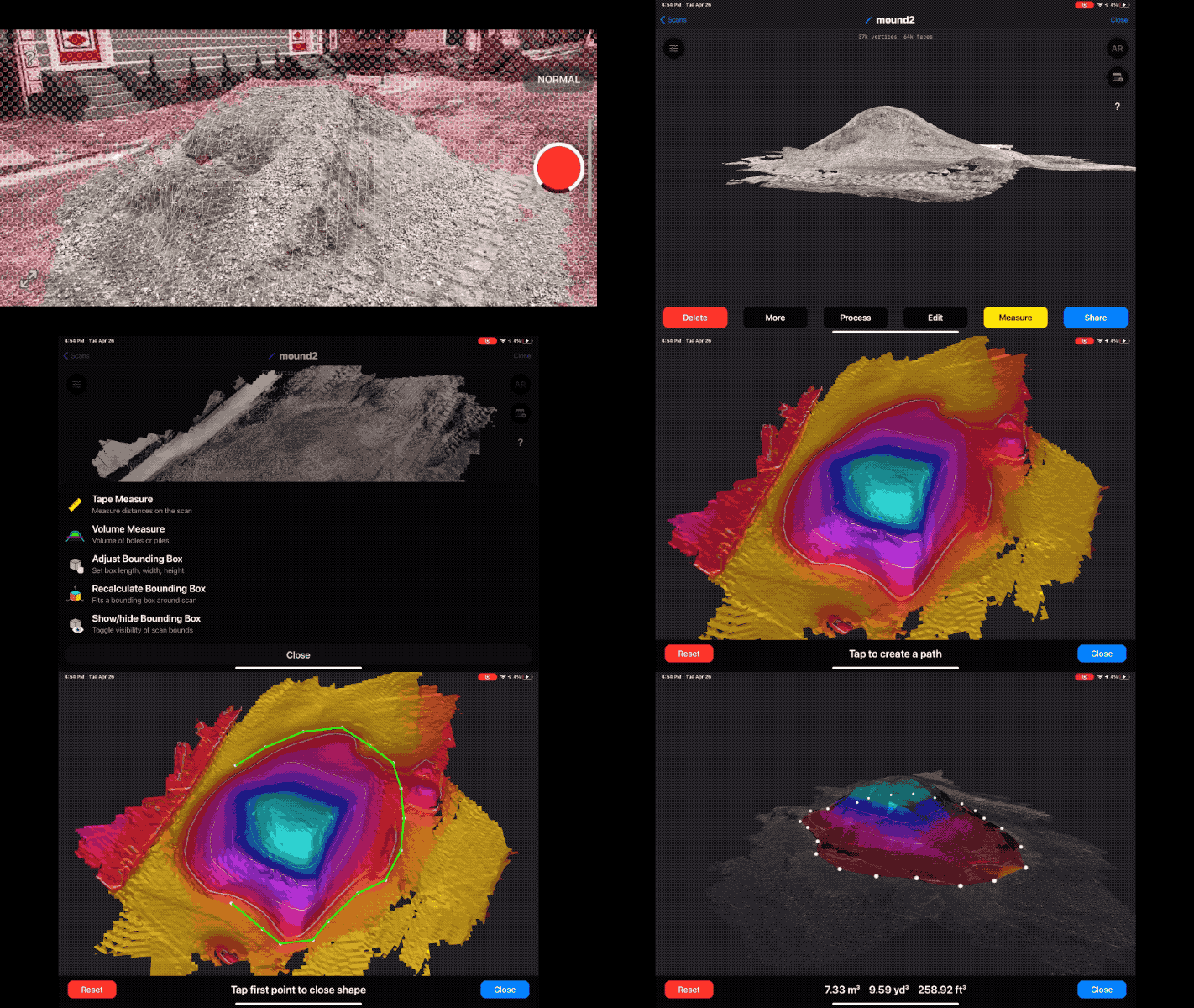
- Point-to-point distance
- Surface area
- Volumetric stockpile
- Cut / fill over time
- Cross-section profiles
- Export to report
Centimeter-accurate positioning, georeferenced to the world.
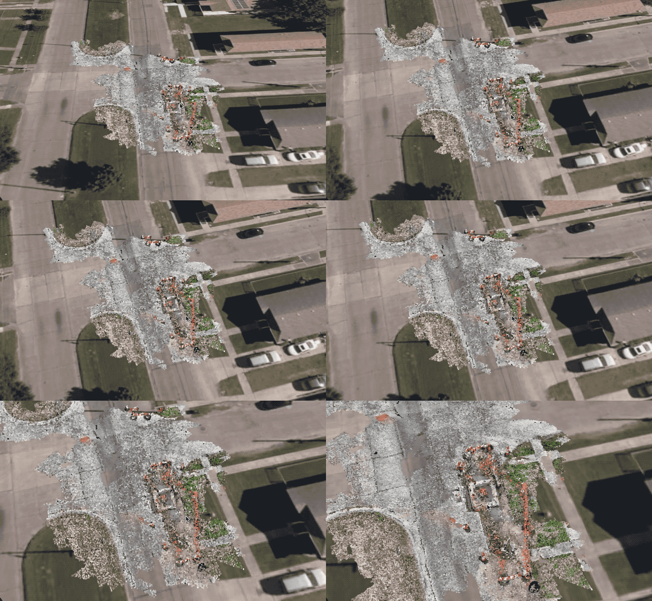
- RTK & PPK GNSS
- ArcGIS / QGIS native
- Coordinate transforms
- Overlay on infra maps
- Geodetic anchors
- Time-series alignment
Inspect at 1:1.
On-site, without being on-site.
Walk through your captures in full spatial 3D on Apple Vision Pro. Examine assets at true scale, share the room with remote experts, decide together.
Walk the capture
Spatial 1:1Step inside the reconstruction at the original scale of the asset. The eye does the inspection — RadianceView gets out of the way.
Shared rooms
Co-presenceTwo engineers, ten thousand kilometers apart, in front of the same surface. Spatial pointers replace screenshots.
Native point cloud
NativePoint cloud and splat layers render natively, with full anchoring to spatial annotations and measurements.
 Immersive 3D Review
 Point Cloud Navigation
Update the record from the field.
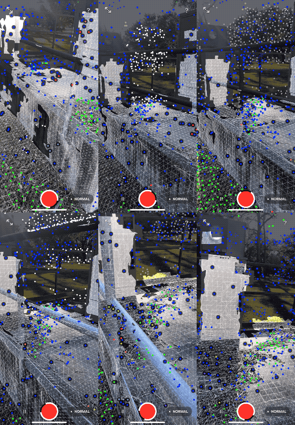
Any iPhone with LiDAR augments existing captures. The digital twin stays current — without convening a capture team.
Augment existing splats
In-placeDrop new LiDAR slices straight into the existing reference. Registration is automatic.
Field-ready notes
SyncInspection notes, photos, and voice memos sync to the cloud and bind to spatial coordinates.
Compare to baseline
DiffSee deltas against last capture — instantly, on-site, before you put the phone away.

Stop documenting.
Start deciding.
Join Airbus, Mercedes, Volkswagen, and Michelin in moving from raw 3D files to a complete system of visual record.
Tell us what you need to see.
RadianceView is in early access. Send a few details and we will reply by email.
Already have an account? Sign in.